
Strava art, already planned
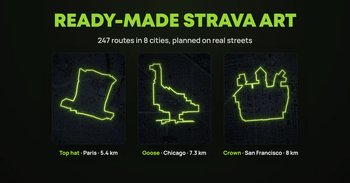
Planning GPS art is half the fun. But some evenings you just want to lace up and run a giraffe. So we planned the routes for you: 247 of them in eight cities, every one already on real streets and ready to download.
Pick your city
- New York: 20 routes
- London: 34 routes
- Paris: 43 routes
- Barcelona: 36 routes
- Chicago: 44 routes
- San Francisco: 26 routes
- Rome: 25 routes
- Buenos Aires: 19 routes
The shapes: giraffes, butterflies, anchors, geese, keys, top hats, high heels, a cello in Paris and a brontosaurus in Buenos Aires, 55 different ones in all, and never more than two of one shape in a city. Most routes are 5 to 9 km, so an evening run or a short ride.
What's on a city page
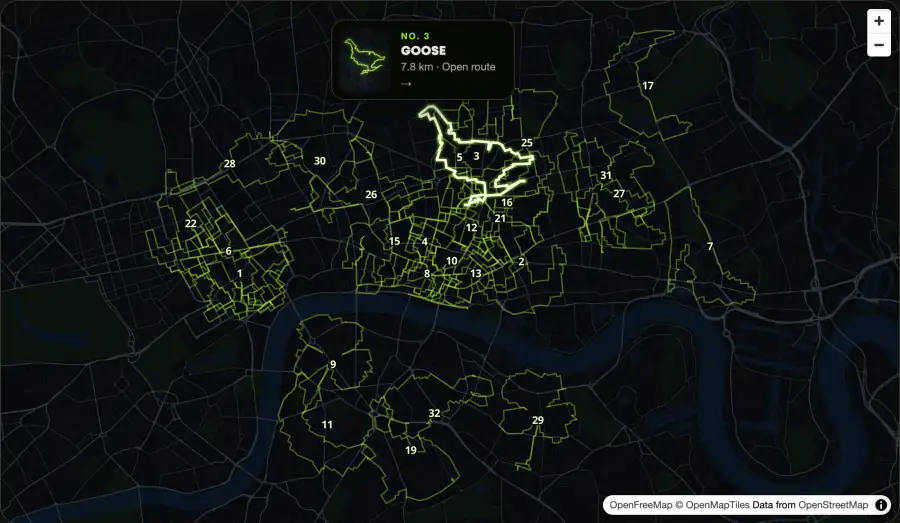
At the top, a map with every route in the city, numbered. Tap a route on the map to see what it draws, then tap the card to open it. Below the map, every route has a card with its shape and distance: our favorites first, and every shape once before any comes back.
Run one in three steps
1. Open a route
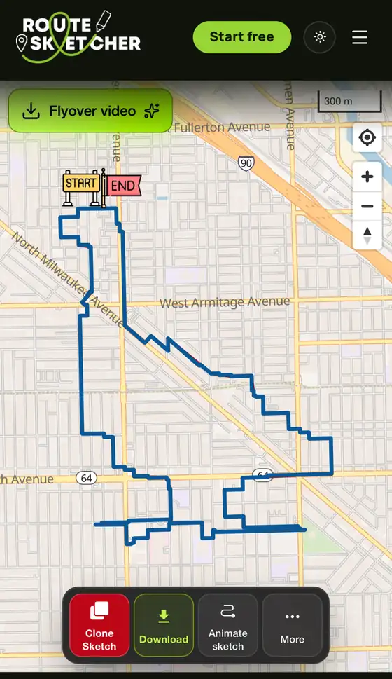
Tap a card or a route on the map. The route opens full size on the map, with its distance.
2. Download the GPX
Sign in (a free account is enough), tap Download and pick Download Snapped GPX.
3. Load it and go
Load the GPX into the app you run or ride with: Garmin Connect and your watch, Strava, Komoot, Coros or Google Maps. Follow the line, upload the activity, and the shape shows up on your Strava map.
Want to change it?
Tap Clone Sketch and pick one:
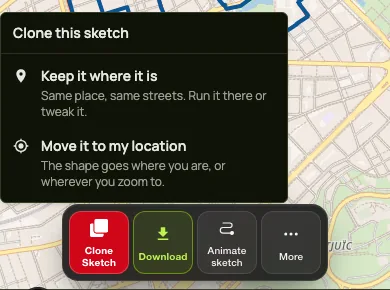
- Keep it where it is: the route opens in the editor on the same streets, so you can tweak it and save your own copy.
- Move it to my location: the shape moves to where you are, or wherever you zoom to, and snaps to your streets.
Your first 2 sketches are free.
How we found them
Usually you draw a shape first and then fight to fit it onto the streets. This time we went the other way and looked for shapes the streets already make. We tried each shape at many sizes, angles and spots in every city, kept the routes that still clearly look like the shape, and dropped the rest.
Grid cities like Chicago, New York and Barcelona draw with straight, blocky lines. In London and Rome the lines wander more, following the old streets.
Not in one of these cities?
More cities are on the way. Until then, draw your own: the Strava art guide shows how, from picking a shape to snapping it to your streets.